

June 17, 2021 1:00 pm
Derrick Dasenbrock, P.E., Geotechnical Engineer, Resource Center, Federal Highway Administration; Benjamin Rivers, P.E., Senior Geotechnical Engineer, Resource Center, Federal Highway Administration; and Q&A panel member Romeo Garcia, Bridge Construction Engineer, Federal Highway Administration
Webinar Documents:
Bring Your A-GaME to ABC - Adding Project Value Using Newer Geotechnical Tools - pdf of presentation
Q&A Session - pdf
Reference 1: EDC-5 A-GaME Winter Webinar Series listing and launch page
Reference 2: FHWA EDC-5 A-GaME webpage
Reference 3: A-GaME in ASCE Geo-Institute’s January/February 2021 GeoStrata issue
Reference 4: Geo-Institute's GeoStrata Publications webpage
Reference 5: Presentation on the FHWA EDC-5 A-GaME
News - June 17, 2021 - pdf of presentation
Description: While ABC is often related to structural, construction, or construction management disciplines, other workflow tasks can be accelerated to shorten overall project delivery time and reduce the likelihood of unforeseen construction delays. Developments in geotechnical engineering are contributing to efficient design, reduced risk, and accelerated construction. Advances in digital field instrumentation and data processing allow geotechnical explorations to be conducted faster, with improved quality, and over larger volumes of material below bridge construction or reconstruction sites. Exploration geophysical methods, cone penetration testing, measurement while drilling, and other techniques are faster than traditional methods and can accelerate project workflow in the design and construction phases. These techniques are part of FHWA’s EDC-5 “Advanced Geotechnical Methods in Exploration” effort- the “A-GaME.” Improved site characterization leads to proper project scope and the likelihood that appropriate means and methods for foundation construction are employed. Risk of change orders and project delay can be reduced – and in many cases these newer methods assist foundation design optimization – leading to shortened construction timelines. This presentation includes examples of the use of these techniques on various construction projects.
Presenters:

Derrick Dasenbrock, P.E.
Geotechnical Engineer
Resource Center
Federal Highway Administration
Phone: 202-923-0972
Email: derrick.dasenbrock@dot.gov
Benjamin Rivers, P.E.
Senior Geotechnical Engineer
Resource Center
Federal Highway Administration
Phone: 678-613-2807
Email: benjamin.rivers@dot.gov
Presentation Photos/Graphics:

1) Electrical resistivity geophysical survey revealing bedrock profile imposed over site photo of excavated bridge site during construction in Duluth, MN (Photo courtesy of MnDOT)
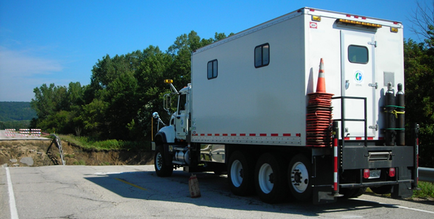
2) MnDOT 30-ton CPT truck at Money Creek Bridge washout after flash flooding along MN Highway 74 in Whitewater State Park (Photo courtesy of MnDOT)
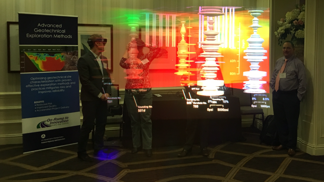
3) Engineers show potential for augmented reality as design aid to visualize subsurface data below proposed bridge (Photo courtesy of FHWA)
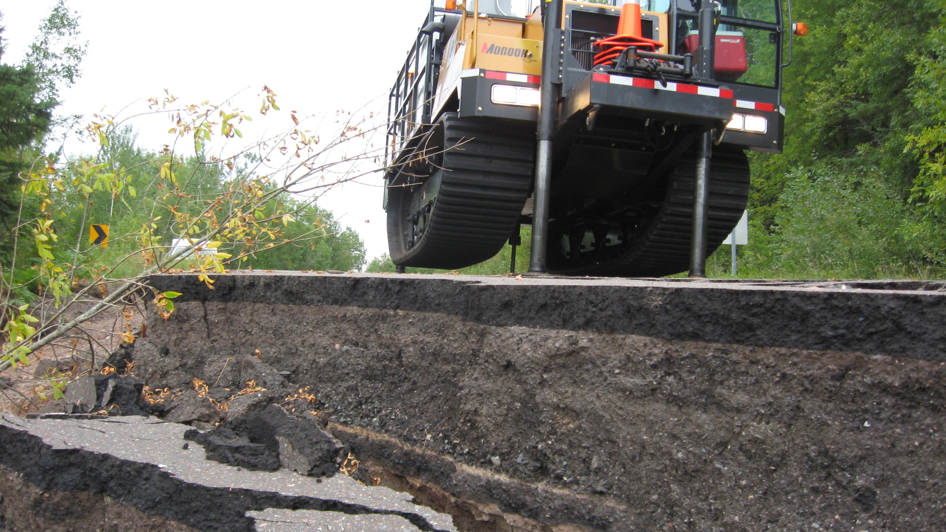
4) MnDOT track mounted CPT rig at site where flash flood destroyed roadway embankment and new bridge was being designed and constructed using emergency contract (Photo courtesy of MnDOT)
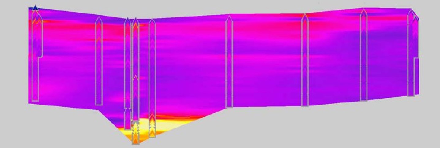
5) Estimated geo-spatial variability in thick clay deposit using CPT sounding data as reference on bridge project in St. Vincent, MN (Photo courtesy of MnDOT)